Command information, worn on the face.
A research and development programme across three connected technologies — display glasses, a rugged tablet and drones — building a single command picture for the Incident Commander. We are working with real hardware to demonstrate how much of this can be delivered with technology available today.
CommandLens is an active research and development programme. It is not yet available as a product and is not certified for operational use. We are publishing the work early because the most valuable input comes from officers who command incidents — and because demonstrating what today's technology makes possible is the point of the exercise.
What it would look like on the ground.
Two short films of the same moment — a commander at a yard fire, identifying a stack of gas cylinders against the building. Watch what the tablet does, then see the same moment through his eyes. Both are generated visualisations of the concept.
The tablet marks the hazard
A bracket on the tablet locks onto the cylinder store and rings it amber. The same alert glints once in the lens.
What the lens actually shows
Note how little is there, and that the centre of vision is empty. That restraint is the design, not a limitation.
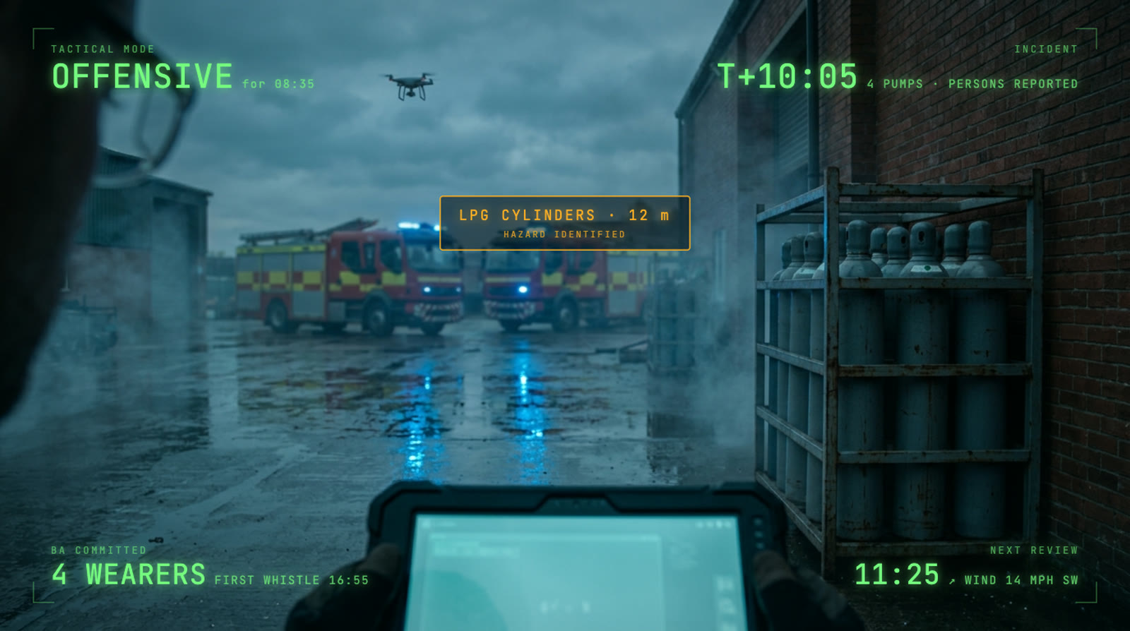
Six things, and an empty middle
The films move too quickly to read, so here is the same lens held still. Tactical mode, and how long it has run. Incident time, pumps, persons reported. Breathing apparatus wearers and the first whistle due. The next review countdown, and the wind. One amber slot for a value that has just changed. Everything sits at the edges and the centre stays clear — the display supports the commander's view of the building rather than competing with it.
Three technologies, one command picture.
Each strand does the job it is best suited to. The glasses hold the handful of values an officer should never look down for. The tablet carries everything that rewards a considered look. The drone supplies the view that cannot be seen from the ground at all. Together they give one picture, assembled from three vantage points.
The glasses
- Tactical mode, and how long it has run
- Breathing apparatus crews and time to the first whistle
- The next tactical review countdown
- Wind, and one slot for something urgent
The tablet
- Maps and site specific risk information
- Resources, appliances and ETAs
- The decision log, written as you go
- An augmented view of the ground in front of you
The drones
- Fire perimeter, spread direction and unburnt fuel ahead
- Flood extent, current and casualty drift at water rescue
- Crew and appliance positions relative to the head
- An overhead plate feeding straight into the tablet map
What the work has established.
The lens is a notification display, and that is an advantage
An officer can absorb about six glanceable values, and designing to that limit changes the hardware question entirely. Sports eyewear built for bright outdoor use delivers exactly this, with an open developer interface, at a fraction of the cost of augmented reality eyewear.
Direction accuracy is the problem worth solving
Placing a marker accurately at thirty metres requires the device to know its heading to within a couple of degrees, which a magnetic compass cannot deliver alongside several tonnes of appliance. Visual positioning solves it where imagery exists, and a manual two-point alignment covers the rest.
The overlay states its own accuracy
Every marker carries a confidence indicator, and the display holds back rather than place something it cannot place accurately. Building that in from the start is what makes the picture trustworthy enough to command from.
Aerial reconnaissance transforms wildfire and water rescue
At a building fire an overhead picture supplements what the commander can already see. At a moorland fire or a flood it becomes the primary tactical picture, because the incident extends over the ridge or past the bend. This is where the drone strand delivers most.
Autonomy is the next step for the drone strand.
Autonomous aerial reconnaissance
A drone at an incident currently needs a pilot, and that pilot is a firefighter who could be deployed elsewhere. The line we are developing is an aircraft that flies the survey itself, and a tablet that reads what comes back against operational guidance and tells the commander what it means.
Self-navigating survey
The aircraft flies its own pattern around the incident ground instead of being hand-flown, so nobody is taken off the fireground to operate it.
Identify hazards and people
Recognise the shape of the incident from above — cylinders, tanks, vehicles, the fire perimeter — and flag people in places they should not be, alerting the commander to danger developing behind them.
Recommend actions from guidance
The tablet already reads scenes against NFCC National Operational Guidance elsewhere in our toolkit. Pointed at a live aerial feed, the same approach turns an observation into a suggested action the commander can accept or reject.
This strand is at research stage. Autonomous flight at an incident carries clear regulatory requirements, and every recommendation is presented for the commander to accept or override. The judgement stays with the officer. Our interest is in how much capability today's technology can put at their disposal.
Shape what we build next.
If you command incidents, one question shapes the next version more than any other: of the six values in that lens, which earn their place, and what is missing? Tell us, and we will build around the answer.